
Here, we share some insights for those unfortunate enough to suffer a breakdown or emergency this winter. We also provide you with seven simple ways to highlight your location and further assist recovery professionals.
Apps and Location signs
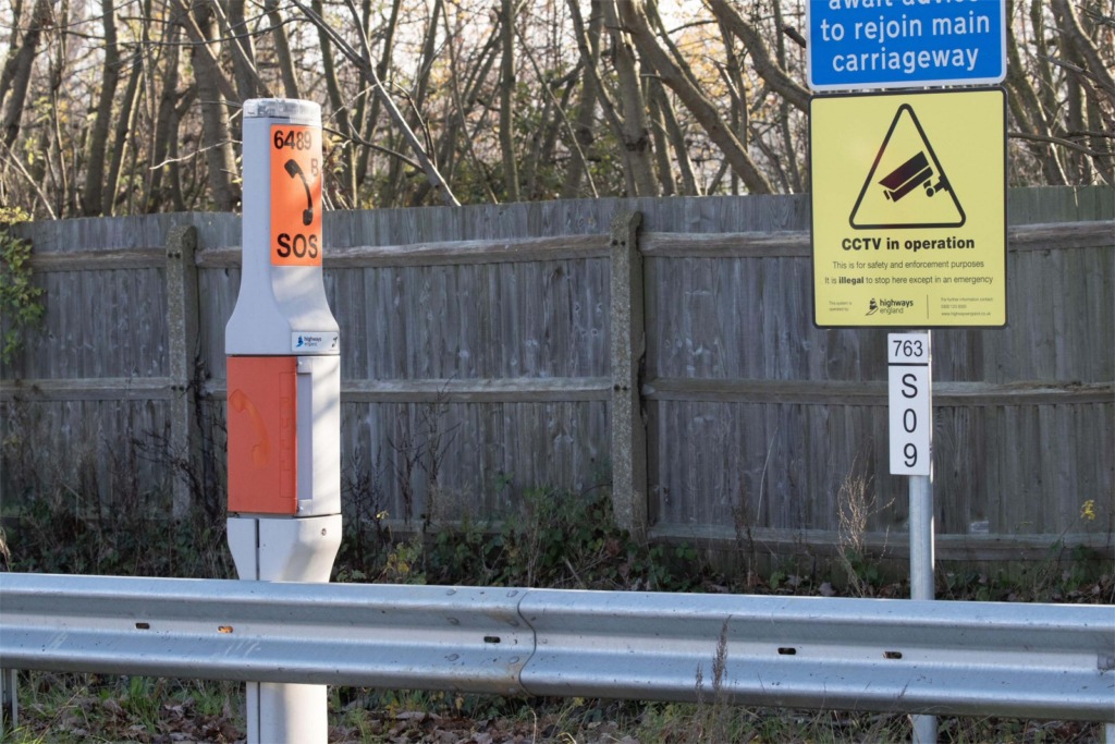
Breakdown apps remain the easiest way to report your location and track your recovery waiting time. Motorists should, however, be aware of other ways to communicate their position. Driver location signs positioned along the hard shoulder of motorways and A-roads should be used by to describe an exact location to the emergency services.
Types of Location Signs
Two types of driver location signs exist. The most common featured on motorways across the UK, are distance marker posts, which are short, white signs with red reflectors and a blue strip. These signs display two lines of numbers and are installed every 100-metres. The top line of numbers explains the distance along the motorway in kilometres (km) from a given location which the emergency services will be aware of. The lower line shows the tenths of kilometre. The marker posts’ shorter side also provides a directional arrow with an image to inform of the nearest emergency roadside telephone.
In England, more visible rectangular blue signs appear on poles along the hard shoulder of motorways and some A-roads. These are positioned every 500-metres (550-yards). These signs display three pieces of information. The first line shows the road identifier, which states the motorway or A-road, for example, M25 or A1. The second line contains the carriageway direction identifier letter, which is normally “A”, “B”, “J”, “K”, “L” and “M”. The letter “A” stands for “Away from London” and is used for carriageways travelling away from London or clockwise on orbital motorways. “B” often stands for “Back to London” or anticlockwise on orbital motorways. Meanwhile, location numbers on the third line, increase in the direction of travel along the “A” carriageway or decrease in the direction of travel along the “B” carriageway. The letters “J”, “K”, “L” and “M” just indicate junction slip roads.
It’s beneficial to know that the numbers on driver location signs are not a grid reference and that they ascend or descend from a notional start point of the motorway. Driver location signs are designed to help motorists identify their exact location to breakdown providers or the emergency services.
Expert Advice for a Winter Breakdown
Experts also recommend seven other simple, safe and effective actions that may help motorists become easily identifiable in a breakdown scenario in difficult winter conditions:
- Wipe down dirty number plates on vehicles affected by winter grime
- Regularly clean all lights so vehicles can see and be seen
- Keep vehicle bodywork clean as reflective cars are easier to spot than dirty ones
- Place a Hi-Vis vest in the back window to increase visibility at the side of the road
- State local landmarks as this helps recovery professionals that are local to the area
- State any identifiable vehicle features such as a roof box or a bike rack
- Use the Start Rescue app or What3Words to find and report your exact location